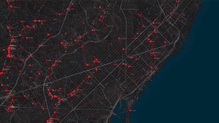
The Geospatial Tools for Cities Focus Group was built considering the growing need of public authorities from all levels to ensure informed-based decisions for sustainable and long-term solutions to their challenges. Because of their increased exposure to the effects of climate change and their high population densities, combined with increasing urbanisation, cities must constantly adapt to ensure safe and sustainable conditions for their inhabitants, often without adequate means. In this regard, geospatial tools and data have an enormous potential to support tackling a broad range of sustainability challenges, such as climate adaptation or disaster risk reduction. Solutions do exist, and local authorities should know their benefits. Therefore, identifying the priorities of cities and local authorities and providing them with adequate tools is crucial for the sustainability of urban environments.
The Geospatial Tools for Cities Focus Group will provide a platform for local decision-makers, industries, investors, researchers, and other smart city actors to explore innovative solutions using geospatial data in an accessible and comprehensive format.
Objectives
The ultimate objective of the focus group is to create a shared space for different actors to explore:
- How cities can benefit from using geospatial data
- What challenges/barriers do they face in doing so
- Presentation and exchange of best practices and success cases
- Identification of project opportunities
Approach
The first presentation of the focus group will be done at the Smart City Expo 2024 in Barcelona on 5 November at 16:30 CET. All session attendees will be encouraged to join the Focus Group. The Focus Group will start in December 2024 with a hybrid event during EURISY's member's day and end on June 2026, with a final event still to be defined. Its participants will meet online at least two times each year. The group will also meet on an ad-hoc basis, if needed, to discuss specific matters.
Activities will include, but are not limited to:
- Answering survey(s) to assess participants prior knowledge of the geospatial tools
- Sharing of best practices, knowledge, and resources.
- Assessment of user's engagement with geospatial solutions.
- Evaluation of participants' procurement/market accessibility.
- Delivery of three webinars (see below). Participants are not required to contribute to the webinars' organisation/content/presentation, but if they are interested, they are welcome to do so.
- Contribution to a solutions booklet following the standardised structure used by the Smart Cities Marketplace. Participant's contributions will be acknowledged in the published document.
Workshops/Webinars
The first workshop will focus on climate change adaptation in urban environments.
The second workshop will address another high-priority challenge in cities: disaster risk management and resilience of critical infrastructures.
The third workshop will provide information on the procurement of innovative geospatial solutions. It will also be used as a milestone to collect first-hand feedback on local decision-makers obstacles in engaging with geospatial solutions.
Participants – who should join?
- City councils and regional governments: departments of urban planning, sustainability and/or smart cities
- Government agencies, including ministries and space agencies
- Private companies providing services related to geospatial tools and data
- Universities/research centres doing research in geospatial tools and data
- Other organisations interested in the use of geospatial tools at city level
The workshops will serve as a primary source of data and information for creating a booklet on the uses of geospatial solutions to answer cities' priorities. The booklet will analyse the data gathered during the workshops and the answers provided to the survey to provide insights on both obstacles to the uptake of geospatial solutions and opportunities. It will include success stories collected along the FG work to promote best practices.
Chair and Co-Chair of the Focus Group
- Chair: the Focus Group will be chaired by Euris, specifically by:
- Annalisa Donati, Secretary General at Eurisy, annalisa.donati@eurisy.eu
- Anaïs Guy, Project Officer at Eurisy, anais.guy@eurisy.eu
- Gabriella Quattropanetti, Communications Officer at Eurisy, gabriella.quattropanetti@eurisy.eu
-
Co-chair: Xavier Casanova Colomé, Expert Green&Digital Transformation, ICLEI Europe, xavier.casanova@iclei.org
About Eurisy: Eurisy is a Paris-based, non-profit association that gathers space agencies, international organisations, research institutions, and private businesses involved or interested in space-related activities across Europe. Eurisy stimulates dialogue and collaboration between public institutions at any level, including SMEs, industry, and academia, from the space and non-space sectors to fulfil its scope. The goal is to build solid relations with communities new to space, encourage innovative uses of satellite applications to respond to today's challenges, and share experiences among professionals from different backgrounds. For over three decades, Eurisy has worked to put civil society at the core of the space value chain.
About ICLEI Europe: ICLEI – Local Governments for Sustainability, founded in 1990 as the International Council for Local Environmental Initiatives, is the world's leading network of local and regional governments committed to sustainable development. ICLEI believes that local action drives global change and that the leadership of local and regional governments can make a major difference in addressing complex environmental, economic, and social challenges.
This focus group will not be used to promote any specific tool, vendor or solutions provider but will be a group to share experiences, best practices and success cases.
